SW Montgomery is the main east-west corridor of the Portland State University (PSU) campus. The bookstore, the two busiest MAX stations, the Urban Center, University Plaza, Smith Memorial Student Union, Simon Benson House, the new business school, the Campus Rec Center, PSU Farmers Market, and other important campus destinations are all located along SW Montgomery.

Southwest Montgomery is also the *only* street that contains ALL FOUR parks and gardens on campus: Pettygrove Park, the South Park Blocks, the Oak Savanna, and PSU Community Garden. No other street on campus contains more than *one* green feature.
May 25, 2018 update: Long ago, I asked Portland State University and the Portland Bureau of Transportation to make THIS block of Montgomery car-free. Today it was the scene of a terrible hit-and-run where an SUV was used as a weapon to threaten the lives of three women who were hit. I’ve been *telling* everyone I can for at least a year that something like this was *bound* to happen at this spot!

Montgomery is also the only street that reaches the Willamette River—and the only street that provides a relatively safe crossing of both Naito Parkway and Harbor Drive.

SW Montgomery is the main artery of campus; the Urban Center pictured below is along SW Montgomery, and PSU’s three busiest transit stops are all along the edges of PSU Urban Center.

Nearly all of SW Montgomery through campus is car-free. And if ONE key block (just left of this image) were made car-free, it would create an incredible, safe, welcoming, people-friendly corridor that would dramatically change the feel of the entire campus.
Jonathan Maus, who runs the greatest bike blog in all the land, wrote a BikePortland article about my car-free idea for the block of SW Montgomery between 6th and Broadway. Pictured below, this block cuts off ALL east-west connectivity on campus, as this post will show in detail.

The block above was car-free for over a year while the new business school was under construction; hardly anyone even noticed. Cars NEVER should have been allowed back on this block.
And again, the despicable hit-and-run on May 25, 2018, makes it all the more obvious that a major downtown campus with 30,000 students needs to prioritize PEOPLE over CARS. These are more scenes from the intersection of Broadway and Montgomery:


To demonstrate exactly why this block *must* become permanently car-free, I’ll take you on a tour of the entire length of SW Montgomery on campus from east to west.
Touring the entire Montgomery corridor, starting from my balcony
Interestingly, the best overview of Montgomery St, its potential, and current shortcomings, is right from my balcony! This is my western view, straight up SW Montgomery. It shows the streetcar tracks that still need to be fully separated on 4th Avenue (more on that later). After passing through Pettygrove Park, Montgomery continues for one awkward block (after crossing annoyingly wide one-way 4th Avenue) to reach PSU’s beautiful University Plaza hub before continuing through three more parks toward the West Hills and Portland’s signature parks:

Where the westward trail of SW Montgomery actually begins
Montgomery Street is the only street running through the PSU campus that extends east all the way to the river, where it terminates at a beautiful park and marina in RiverPlace. But Montgomery’s flow to the river is greatly severed by two huge roads.
Thus, the *real* pedestrian journey along Montgomery through campus starts at this awkward “overlook” of a mostly empty two-block-long parking lot that itself overlooks busy Harbor Drive:

We’ll now march west along the pedestrian-only Montgomery corridor. Note: a crosswalk (and usually courteous drivers) helps people get across busy Pacific Highway that separates the lonely “overlook” in the image above with the car-free corridor (pictured below) that leads to 1st Avenue, a bizarre one-way street with back-in angled parking. SW 1st is a lifeless car sewer, but at least traffic is calm. SW 1st is unseen at the back of this image:

SW Montgomery then takes a short jog to the left (south) to get around the blank-walled office building (and giant parking garage) seen behind the man in the above image.
Montgomery then starts its real journey west through the PSU campus, starting with stairs into Pettygrove Park and the historic 12-square-block Halprin Sequence, seen below. Note: the wall on the left side is part of the 23-story Harrison East tower where I live.

Pettygrove: Montgomery’s eastern edge
The PSU campus portion of SW Montgomery begins at Pettygrove Park, a beautiful place that many PSU students may not even know exists. The beautiful sculpture (which can look like gold in certain lighting) is called “The Dreamer.” This young man is perhaps dreaming of flying. And here’s a little-known fact: When it rains, the “modern river goddess” structure is designed to sound like a gentle kettledrum, rather than a ringing sound produced from rain hitting a hollow structure.

And if you’re lucky, you can watch Pettygrove Park’s resident owl do a little dance and appear to even smile:

Concerts and Shakespeare plays are often performed in the summer at Pettygrove Park:

The biggest event I ever saw at Pettygrove Park was something I first *heard* from my balcony. I had to check it out to see what on Earth it was; it was apparently one of the largest “Ingress” (video game) events in the U.S. I love when events like this activate the beautiful but very quiet Halprin Sequence:

SW Montgomery continues west into campus along the corridor where folks are walking below. About half of pedestrians turn left at the sculpture to continue north through the Halprin Sequence to Keller Fountain. The other half turns right to either catch the streetcar or continue south into Lovejoy Fountain Park.

Before continuing west on Montgomery: a tour of the Halprin Sequence
OK, I’ve hinted at this mysterious “Halprin Sequence” a lot. So, before we continue west along Montgomery, let’s explore the Halprin Sequence a little. It runs parallel to the PSU campus and borders it to the east. It’s an incredible 6-block-long, 2-block-wide corridor that’s almost entirely free of cars.
The Halprin Sequence is on the National Historic Register, and New York Times architecture critic Ada Louise Huxtable called it “one of the most important urban spaces since the Renaissance.” Yet, hardly anyone in Portland has ever *heard* of the Halprin Sequence, which literally borders downtown Portland to the south.
Nearly everyone in Portland is certainly aware of Keller Auditorium, Portland’s largest performing arts venue, as well as the giant Keller Fountain across the street:


What very few people realize is that Keller Fountain is the northernmost end of the Halprin Open Space Sequence (designed by famous landscape designer Lawrence Halprin) that connects four fountain parks with a parallel 6-block-long north-south network of peaceful car-free paths:

There are several treasures along the Halprin Sequence trails that few are aware of. Garden Bar anchors a massive interior space right along the Sequence. Pictured below is roughly half of the space. It’s especially inviting in winter, when the long two-sided fireplace rages, and people grab every available chair to work on projects alongside the fireplace:


There’s even a regulation bocce ball court on the 200 SW Market building’s courtyard rooftop! It’s gorgeous, day and night. And visionary owner and developer John Russell is even adding *two* new glass-covered elevated atriums that will extend even farther out from the building. They should be completed by the end of 2018.

Pettygrove Park is the second park encountered as you follow the trail south through the Halprin Sequence. Each park has its own water feature. The normally super quiet parks are occasionally activated in summer by lunchtime concerts and Shakepeare plays.

Again, SW Montgomery is the *only* car-free entrance to either the east or west edge of the Halprin Sequence. It passes right through Pettygrove Park:

From Pettygrove, two parallel trails (again, entirely free of cars, except for where they cross Harrison St) continue south to Lovejoy Fountain Park:

Pettygrove and Lovejoy are cleverly named parks. They’re named after the two men who tossed a coin for naming rights to their fledgling city. Clearly, Pettygrove from Portland (Maine) won. But Lovejoy ended up with one of the greatest protected views of Mt Hood in the entire downtown area:

Free summer events are offered to bring people into the beautiful Halprin Sequence and discover this little-known corridor on the National Historic Register:

Lawrence Halprin knew that the view of the West Hills would eventually get blocked by buildings. So, in 1965, when designing Lovejoy Park, Halprin created the shelter in the background whose shape evoked the silhouette of the West Hills:


The Halprin Sequence continues south one long block past Lovejoy Park. It’s a very quiet corridor that could definitely use some activation. Holding some PSU classes in the perpetually vacant retail spaces would do wonders!
Hot Pot City (with the curtain, to the left) is a really cool restaurant where you cook your hand-selected ingredients in a large boiling broth (several flavors to choose from) right at your table. Their selection is amazing and really fresh. It’s a shame more people don’t know about this restaurant—or the great bookstore (with a fascinating, super knowledgeable owner) next door, to the left of this picture.

The corridor continues south one more quiet, lonely block, mostly lined with vacancies. The other side has active businesses, due to free parking and much more visibility from the street.

The final fountain is “Source,” from which everything flows gradually downhill into giant Keller Fountain downtown. There’s not much to see at Source fountain, even when water’s bubbling out of it:

A MAX station serving the Orange line to Milwaukie borders Source fountain on Lincoln St. This lonely stretch of the Halprin Sequence would be greatly activated when and if PSU ever redevelops the sprawling University Place Hotel & Conference Center that it recently bought. It’s located right at this MAX station.

Running along the east side of University Place (across the street from the MAX station above), the Halprin Sequence unofficially continues south for one more block, heading directly to the center of the campus surrounded by the 18-story, 22-story and 26-story American Plaza Condominiums, built between 1972 and 1980.

This concludes the north-to-south tour of the Halprin Sequence! 🙂
Leaving the Halprin Sequence to continue west on Montgomery
From back at Pettygrove Park, we’ll continue west along SW Montgomery (currently still a trail), straight through the heart of campus. Three different pedestrian corridors converge near this bench at Pettygrove Park’s western edge, which is along Montgomery:

Going west a block and looking back at where we were just standing, the view changes quite a bit (pictured below); it’s of a full-block-sized building under construction. The building (called The Collective on Harrison) borders the Montgomery pedestrian trail (in the trees in the background) that connects that Halprin Sequence to campus.
Again, Montgomery is the *only* street that connects *any* two or more greenspaces on the entire campus, and it’s the only street connecting to the Halprin Sequence on both the east and west sides.


Proceeding west from 1st to 4th along Montgomery, through Pettygrove Park and the trails the lead to it from the east and west ends of the park, has been blissfully car-free up until this point.
Then, when you reach 4th Avenue, you’re suddenly jolted right back into the “flee rapidly by car to the suburbs” 1960s when you have to cross the three-lane (plus parking on both sides) one-way road that might as well be a highway.
It’s 2018—time for SW 4th to be completely re-envisioned (to include a badly needed protected cycle track!) . Cities were designed entirely with private cars in mind in the 20th century; today, cities are ideally for *people*.

Once (hopefully safely) across 4th, the Montgomery pedestrian corridor turns into a very short-lived (200-foot-long) street for cars between 4th and 5th. Streetcars can get horribly jammed up in this stretch, between sharing a track and getting stuck behind cars. Allowing cars on this minuscule stretch was the default in the 1970s (and especially before modern streetcars arrived in 2001; Portland was the first city to re-introduce them).
But allowing cars on this stub is pretty ridiculous in a major urban campus, in the heart of a major city in the 21st century. Besides, cars can only proceed westbound, and even then, they can then only turn left (south) onto 5th. PBOT needs to make drivers spend the extra 10 seconds driving one more block north to Mill St (which presents the same options as Montgomery), thus enabling streetcar commuters to save thousands of hours of combined time and daily headaches.
Because of THIS ONE BLOCK, I never, ever take the streetcar. *No one* likes this block, especially car drivers!

FIX this, Portland! Finish separating the streetcar tracks *and* provide a beautiful, truly urban connection to the Halprin Sequence!! And with an exciting, first-of-its-kind new building going up soon that will be shared by PSU, PCC, OHSU and the City of Portland (not the one currently under construction—but another new building going up on the left side of the image below, where all the cars are parked behind the turning streetcar), it’s a perfect opportunity to make the block pictured above and below an *active transportation* corridor:

Speaking of active transportation (which is all non-auto-based transportation), people have plenty of non-car options once they reach the next block: 5th Avenue, which runs directly past the east edge of University Plaza. This is at the corner of 5th and Montgomery and looking north at southbound 5th Ave. Five parallel, separated transportation modes (other than driving) are possible: walking, light rail, bus, streetcar, and bike (there’s a bike lane hidden to the right of the streetcar):

The center of it all: University Plaza
The corner of 5th and Montgomery is the busiest transit intersection on the entire PSU campus. Three light rail lines, two streetcar lines and two bus routes stop at this corner. The left side of the picture, where the women are walking across the streetcar tracks, is where University Plaza (typically called PSU Urban Center) starts:

Crossing 5th Avenue and continuing west, Montgomery Street becomes the main entrance to—and the only “street” (technically a car-free corridor) in the heart of—University Plaza (again, often called Urban Center). The beautiful piazza is home of the campus bookstore, PSU Rec Center, the College of Urban and Public Affairs, the School of Social Work, numerous retailers, and, of course, the Portland Streetcar passing through it all:

PSU Urban Center is filled with activities—and is definitely activated—throughout the year:


Several buildings surrounding PSU Urban Center offer amazing views
Check the captions to read descriptions—and check the views out for yourself! 🙂

Below is a view of the School of Social Work’s green roof, as well as the not-yet-finished green roof of the new business school across the street. I’ll include separate images of the Karl Miller Center (business school) green roof. You can also see some of the West Hills in the background.
An important note is that SW Montgomery runs directly below the elevated walkway on the right side of the image. That exact block of Montgomery (between 6th and Broadway) is THE key linear block that needs to be made permanently car-free!


Karl Miller Center–along what SHOULD be a car-free block of SW Montgomery
The beautiful new business school is directly across 6th Avenue from PSU Urban Center. This is where SW Montgomery reverts—again, for one frustrating and *absolutely unnecessary* block—to becoming a street for cars. And it’s a one-way coming BACK east, which makes it all the more confounding. I’ll explain the school’s rationale for this after showing a few pictures of the gorgeous new business school.


And then it all goes to hell for a block
The new business school runs right along SW Montgomery between 6th and Broadway. This block was closed to car traffic for over a year during construction; hardly anyone noticed or cared! Cars *never* should have been allowed back on.
This is how SW Montgomery between 6th (PSU Urban Center) and Broadway looks most of the time now:

The business school that lines this entire block is FULL of entrepreneurs and innovators! Surely they can come up with better uses than empty pavement for a lonely one-way street and a couple of parking spots. Ah, speak of the devil: here are two eco-innovators! 🙂

Biking is actually illegal (both against the one-way and on the sidewalk) on this pathetic, dead block that connects the two main attractions on Oregon’s most populated campus. Banning cars would make this trip a 10-second bike ride. Instead, cyclists have to travel SEVEN BLOCKS (five of them on dangerous, busy streets, including Clay Street, where drivers are speeding directly onto Hwy 26) to simply go from PSU Urban Center to either Smith Union or the Park Blocks:

The elevated walkway below is a relic from the 1970s. The block of Montgomery that I’d like to see become car-free as soon as possible is directly below the walkway:

This view from Karl Miller Center shows how SW Montgomery really needs to extend the car-free flow through PSU Urban Center beyond 6th Avenue. This single block would allow Montgomery to continue as a beautiful car-free corridor through the South Park Blocks, nearly all the way to 12th Avenue!

It seems ridiculous in Oregon’s largest school (30,000 students), in 2018, in the dense urban center of Portland, to force people to walk in a narrow edge on the extreme far side of this wide corridor, all while big trucks can pull right into convenient angled parking in two seconds:

DePaul University, located in a very densely populated area just past Lincoln Park in Chicago, formerly had a street for cars that ran through a very key block of campus, much like the block of Montgomery between 6th and Broadway pictured above and below.

But once DePaul made that single block car-free, the campus got its beloved centerpiece, The Quad:

But what we have instead is this, right next to the beautiful new business school, and across the street on both sides from multiple blocks of glorious car-free Montgomery. How can we transform this street? Imagine what a festive gathering space it could become!

This image faces east toward 6th Avenue. Just behind this image (across Broadway), Montgomery turns car-free again and provides access in seconds to the glorious South Park Blocks:

WHY IS this one block of Montgomery open to cars?!?
Founded in 1946, Portland State University relocated to its current home in 1952, with the South Park Blocks forming the car-free main north-south axis and Montgomery St becoming its main east-west corridor. With two super minor adjustments to SW Montgomery, PSU main east-west *and* north-south corridors could become gorgeous corridors completely free of cars, except at street crossings.

Traffic planning reached its car-centric zenith in the 1950s and 1960s, and thus PSU was unquestionably viewed as a commuter campus. This was further reinforced when I-405 was built in 1969 and formed the incredibly awkward and ugly south edge of campus. And now, we sacrifice lives, placemaking, happiness, and endless people-friendly creative opportunities on the block below—all to let drivers cut through (and to offer all of NINE parking spots). Seriously.

PSU took a decidedly more urban turn (literally) when the beautiful Urban Center was built, making Montgomery even more important as a people-centered east-west connector through campus. The image below looks across to PSU Urban Center from the same spot where the image above was taken. Imagine if pedestrians continued seamlessly from the image below to the image above!

It’s not difficult whatsoever to picture a beautiful westward extension of PSU Urban Center (background) to this stubborn block of Montgomery (foreground). And again, every type of land-based transit borders this block.

But again, WHY is this block STILL open to car traffic?
This is the main reason, and it’s pathetic: PARKING and saving a few seconds for drivers! The campus wants people who park at the ugly 1970s garage pictured below on SW Broadway to be able to cut through the above block of Montgomery if they wish to quickly proceed back north on 6th Avenue:

If drivers leaving Green Zebra didn’t have the option of turning left on Montgomery (which, remember, they didn’t have for over a *year* during KMC’s construction—and no one seemed to mind then!), they could easily drive ONE more block south to Harrison St, turn left and go back north.
Even if you’re traveling at just 12 mph on super wide Broadway and 6th, these two combined extra blocks traveled (a total of 460 feet) would take *26 seconds*. One-way Broadway has plenty of room, and it usually looks about as empty as seen below. Notice the nice 10-foot-wide parking-protected bike lane, too, along with a convenient Biketown station:


So, to save drivers UNDER 30 SECONDS, we’re completely severing the connection from PSU Urban Center to Smith Union, the South Park Blocks and all the other major attractions along SW Montgomery. Smith Union, whose entrance needs major help, would have endless opportunities opened up once cars are removed from that key block of Montgomery.

Opening to PEOPLE the block of Montgomery that connects PSU Urban Center, the new business school, Smith Union and the signature South Park Blocks simply MUST be done. These people are all forced to the edge while drivers on busy, dangerous SW Broadway are allowed to turn onto the tiny block of Montgomery that the young woman in pink is risking crossing. This is so insane that I’m creating an entire “Vision Zero” section immediately following this image.

A “Vision Zero” embarrassment
It’s no exaggeration that walking across Montgomery Street above is quite dangerous. Turning off a wide one-way street onto another one-way street (and immediately onto yet another one-way street)—in the center of a campus of 30,000 students—presents an incredibly dangerous situation. It’s literally the surest way to guarantee crashes that will land people in the hospital or worse. And it continues to be allowed so that drivers can save ~20 seconds on their commutes home (in the heart of public transit and cycling heaven, no less).
Portland says that it’s fully committed to “Vision Zero.” In its Vision Zero Action Plan, the Portland Bureau of Transportation (PBOT) has set a goal of eliminating all traffic deaths and serious injuries by 2025. Well, eliminating car access to this tiny 200-foot block of Montgomery would be the easiest first step PBOT could take.
Plus, the majority of pedestrian deaths occur when drivers turn left through an intersection when the pedestrian has the right-of-way. It’s all the MORE reason to forever ban cars on this block, where drivers can only turn left when both entering and leaving this block.
And here’s the very height of irony: the “Campus Public Safety” building is located directly on SW Montgomery between 6th and Broadway!

Cars have tons of room to zip around the corner from a wide one-way street to another one-way street, with rarely any visible obstacles (other than people, if they’re visible!) in the way. This is the most dangerous possible scenario for people not protected by multi-ton metal cages. The block in the foreground is, once again, that tiny but super key block of Montgomery that MUST become car-free:

I fully realize that PSU needs parking revenue, and PSU Transportation & Parking Services (TAPS) has a lot of issues to balance. TAPS is self-supported; they receive no state or tuition funding. So, they pay for all parking operations, maintenance, labor, transit pass subsidies, and bicycle parking through revenue obtained through parking permits and citations.

TAPS also works on reducing demand for car parking by subsidizing transit passes, installing bike parking and supporting the PSU Bike Hub that I love visiting and supporting, as well (Hi Clint, Ian and everyone!). TAPS also hopes to avoid building expensive new parking garages through traffic and parking demand management. But cycling and transit rates have stagnated for years at PSU. This is an ongoing city-wide issue.

So, I realize that TAPS doesn’t want to lose parking revenue. But closing off that key block of Montgomery wouldn’t deter anyone who needs or wants to park at Green Zebra, the only parking garage whose drivers would be slightly inconvenienced by having to travel an extra 20 seconds or so.
And if ONE life is saved because of closing off car access to arguably the single most dangerous traffic corridor on the entire campus, it would all be worth it… Until then, I won’t believe for a second that Portland takes Vision Zero seriously at all. It’s the easiest possible street closure to make—and one that would benefit the entire campus in ways that we have yet to even imagine.
Continuing west from that awful block of Montgomery and back into Nirvana
Montgomery makes it rightful return to its car-free ways after crossing Broadway. And again, Smith Union, seen here right along Montgomery, will benefit immeasurably once that block in the background is opened up to *people* and endless possibilities:

In the single block between the beautiful South Park Blocks and the dreadful block east of Broadway, the now-car-free Montgomery corridor passes directly between two of PSU’s most important buildings: Smith Union and Cramer Hall. The statue and peaceful park setting (pictured below) that students are enjoying are only a few feet behind the image pictured above:

Imagine a people-filled corridor on SW Montgomery that would connect to this spot just a block away:

A newly car-free block of SW Montgomery could support the City Repair T-Horse! (Hi Sarah Bellum and everyone!) The T-Horse travels to various parks and provides free tea, conversation, cushions and community!

There are so many activities we could balance once we close that block of Montgomery to cars and open it to endless activities; I want to see what your imagination conjures!

A brief tour of the South Park Blocks
Before continuing west on Montgomery, let’s see a couple of attractions on the South Park Blocks since we’re already here. The South Park Blocks form the dominant north-south artery of campus. They run from I-405 (at the base of the beautiful West Hills) all the way north, through the “Cultural District” downtown, and even across Burnside, where they become the North Park Blocks!

The South Park Blocks, lined by the longest, stateliest row of elm trees in any U.S. urban area, were set aside in 1852, just one year after Portland’s incorporation. They even precede New York’s Central Park. The founders had vision to preserve this 24-block-long stretch before the city grew up around them.

The Benson Bubblers are legendary Portland features. Local businessman and philanthropist Simon Benson purchased and installed 20 bronze drinking fountains. There are now 52 Benson Bubblers in Portland, along with 74 single-bowl versions. We’re not sure if he donated the Benson Bubblers to keep loggers out of saloons at lunchtime, or if he was inspired after seeing a girl crying at a July 4th parade because she couldn’t find a drink of water. We’re thankful for them just the same!

The Benson Bubblers above are right in front of Simon Benson’s house (and behind the people), below. It got moved to this spot on campus. Note: the guy on the far right is walking along the car-free Montgomery corridor that continues west from here.

Park Blocks north of Montgomery
I’ll show only a few of dozens of attractions on the South Park (and continuing to become North Park) Blocks north of Montgomery.

The Portland Streetcar crosses the South Park Blocks both one block and two blocks north of Montgomery:

The South Park Blocks continue north into the heart of the Cultural District, where the Portland Art Museum, Oregon History Museum, four major performance halls and other signature museums and cultural attractions are located. Below is a Chinese New Year celebration at the Oregon History Center:

The picture below was taken in front of the Portland Art Museum. My friend Megan McGeorge runs Piano Push Play; she and her team do an *incredible* job of rescuing pianos, decorating them, tuning them, and making dozens available each year for people to play for free before they’re donated to schools, community centers and artists:

Every one of the dozens of pianos in front of the art museum (displayed there at a grand event before being sent to beautiful park locations all over Portland) is truly a work of art!

Life imitates art on the South Park Blocks

There are FOUR churches from built in the 1800s along the South Park Blocks. First Congregational, below, is the newest. The 175-foot-tall building was completed in 1895. It was designed to resemble Boston’s Old South Church, and it’s one of the few examples of Venetian Gothic architecture in the U.S.

Teddy Roosevelt approves of the South Park Blocks and the Cultural District.

Park Blocks south of Montgomery
PSU Farmers Market, the nation’s largest year-round outdoor farmers market, starts right on Montgomery and continues south for several blocks.


You never know what you’ll see at the PSU Farmers Market. And if you don’t get your fill here, there’s *another* farmers market several blocks north in the South Park Blocks.

PSU’s Native American Student and Community Center is a stunning gathering place at the far south end of the South Park Blocks. I have dozens of beautiful pictures of the interior. The two shots below were taken from the green roof. And a bird’s eye view above the Center would reveal the building’s salmon-shaped design and rooftop walkways and ramps that mimic a salmon’s scales and backside.


Continuing west on Montgomery from the South Park Blocks
You’ll soon encounter the Oak Savanna, which is located right along the Montgomery pedestrian thoroughfare. In 2017, the Campus Planning Office hired a landscape architecture firm to create a proposed vision for the space, with help from the community.

Mindfully exploring the PSU campus is never boring. You might even encounter a house being moved right through campus! My friends at Arciform helped fund the move of the Morris Marks house (built in 1880); it moved (at less than one mile per hour) right through the Oak Savanna:

Admiring the move from Oak Savanna:

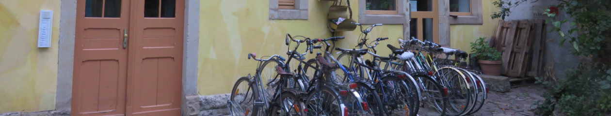
A beautiful green-roof-topped bike garage is just beyond the Oak Savanna along Montgomery:

Montgomery is a beautiful corridor with tons of great views that are sometimes hidden. I have dozens of images like this–just take a walk along SW Montgomery and enjoy!


PSU Community Garden at 12th & Montgomery
The PSU Community Garden and Community Orchard is the very farthest west point of the PSU campus. It’s literally tucked up against a wall overlooking I-405. These pictures were taken when Kirk, Nora and other friends from City Repair and the Student Sustainability Center were working on some installations, fun signage, cob structures (the world’s most sustainable building material) and other fun little projects during the Village Building Convergence, my *favorite* annual event.


Across the street from the PSU Community Garden is the western entrance to the campus, which is along Montgomery. Note: no cars allowed. But all people are welcome.

Continue exploring west on Montgomery past the campus
It’s well worth venturing west on Montgomery just past the campus; you’ll be walking up into the West Hills in no time! And there’s even an off-street shared use path that starts right after crossing I-405 on Montgomery:

The West Hills begin their steep rise just 200 feet beyond Peter W. Stott Community Field, which is totally open to the public:

My very favorite thing to do just beyond I-405 and just south of Montgomery is to *explore the many public stairways* in the area. It’s seriously one of the main reasons I moved near PSU. 🙂


Kids and pets are wonderful explorers, but adults *rarely* go one block out of their normal routes. GO EXPLORE what’s in and around the PSU campus; you’ll be surprised! Plus, if you’re able, climbing public stairways is super fun, and it’s amazing exercise. And you always reach exciting and often surprising new views at the top of each set of stairs.
Flat cities are SO boring! 🙂 Be super thankful for PSU’s amazing setting!


Conclusion: It’s time to make car-free Montgomery a reality!
But first… Admittedly, there’s one additional tiny block of Montgomery that’s open to cars. It’s another one of those annoying one-block, one-way streets. It starts right alongside the Simon Benson house and runs all of 200 feet from the South Park Blocks to the edge of the Oak Savanna. If you’re a PSU student, you know the block well; it’s where Rogue Hall is located.
Notice how the cyclist wanting to head east is forced to use the sidewalk (and the wrong sidewalk, at that):

If there’s ONE block of Montgomery that absolutely MUST remain open to car traffic, this is the one that I can reluctantly accept.
But THIS block of Montgomery, between 6th and Broadway, *unquestionably* needs to become car-free as SOON as possible!! The 1960s called; they want this suburban land use pattern back!
Let’s make this block a SAFE, super welcoming place for PEOPLE instead!

This is an amazingly comprehensive overview. Thanks!
Thank you so much, Professor Shoshkes! I really enjoyed presenting at your class! I can’t wait to hear the creative ideas your students have for activating that key block of SW Montgomery in front of the new business school! 🙂 That block will be a beautiful connection between PSU Urban Center and the South Park Blocks!
Tim….what a well documented “finding of fact” case you have made for this urban pedestrian corridor. I am increasingly dismayed at the lack of appreciation Americans have for design and aesthetics. I think we still have frontier mentality……keep moving, exploit the resources in the new place and then move on to the next frontier and the next. Temporary residents don’t develop a sense value of place or a connection to it.
Keep writing!
Thanks, Mary!! I couldn’t agree more about the American way. I’m going to the CNU (Congress for the New Urbanism) conference in Savannah in May, and I’ll be watching VERY closely to see how serious they are about sustainability. It’s really easy to create a beautiful new place that’s completely disconnected from other communities–or even from the city where this cute new place is developed! It’ll be interesting to hear what the speakers and attendees feel about connectivity, transportation and true sustainability. They’re more of a land use group, but it’s ALL part of the same ecosystem, literally.
Granted our entire transportation, land use, financial and regulatory *system* needs to be dramatically overhauled. Developers, politicians and planners in the U.S. are literally *encouraged* to create almost nothing but non-walkable, single-use, cookie-cutter, low-density, awkwardly zone-segregated (and thus income-segregated), wasteful, maintenance-deferred sprawl.
Waiting patiently for you to come home and fuck me! https://bit.ly/3UIKI2R
Waiting patiently for you to come home and fuck me! https://bit.ly/3UIKI2R